Field Notes · Papua New Guinea
West New
Britain
Volcanoes, reefs and twenty thousand years of voyaging, in photographs
5°30′S · 150°30′E
About these notes
Everything in these pages is real: photographs by travellers, divers, scientists and astronauts, each one credited at the back. Turn slowly.
West New Britain
Fire
The fire mountains
Travel along the north coast of West New Britain and the horizon keeps rising into cones. The island sits where two plates of the Earth's crust press together, and that pressure comes up through the ground as volcanoes.
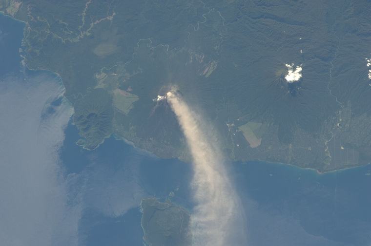
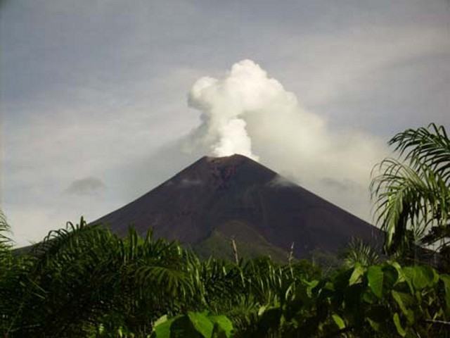
The tallest is Ulawun, one of the most active volcanoes in Papua New Guinea. When it erupted on 26 June 2019, more than 10,000 people moved into care centres within two days. Closer to Kimbe stands Pago, a young cone growing inside the old Witori caldera. About 3,300 years ago Witori exploded so violently that ash buried gardens and forest across the whole Willaumez region.
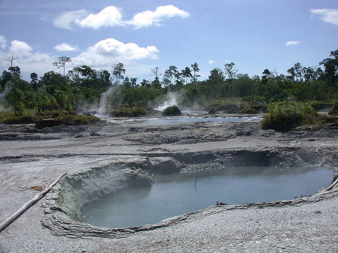
The heat that threatens also gives. It warms the hot springs at Pangalu near Talasea and the bubbling sulphur ponds at Pokili, and it builds the dark, rich soil that feeds gardens and oil palm.
- Ulawun
- 2,334 m, the island's highest
- Last big eruption
- 26 June 2019
- Pago
- a young cone inside Witori caldera
Stone
The glass of Talasea
Long before metal, the sharpest thing in this part of the world was volcanic glass. On the Willaumez Peninsula, around Talasea, eruptions left behind obsidian: black, glossy stone that breaks to an edge finer than a steel blade.
People have come for it for a very long time. Obsidian from Mopir, in West New Britain, has been found in sites on New Ireland dated to around 20,000 years ago, when the sea stood far lower than today. Even then it had to cross open water, by canoe.
Later, Talasea glass travelled astonishing distances. Its chemistry works like a fingerprint, so archaeologists can trace flakes found thousands of kilometres away back to these sources.
- Stone
- obsidian, volcanic glass
- Sources
- Talasea and Mopir
- Oldest trade
- about 20,000 years ago
Flakes still lie in the gardens near the old sources. Look, and leave them where they are.
Read the full chapter →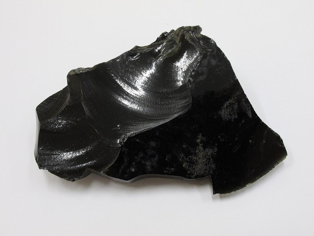
Sail
Lapita voyagers
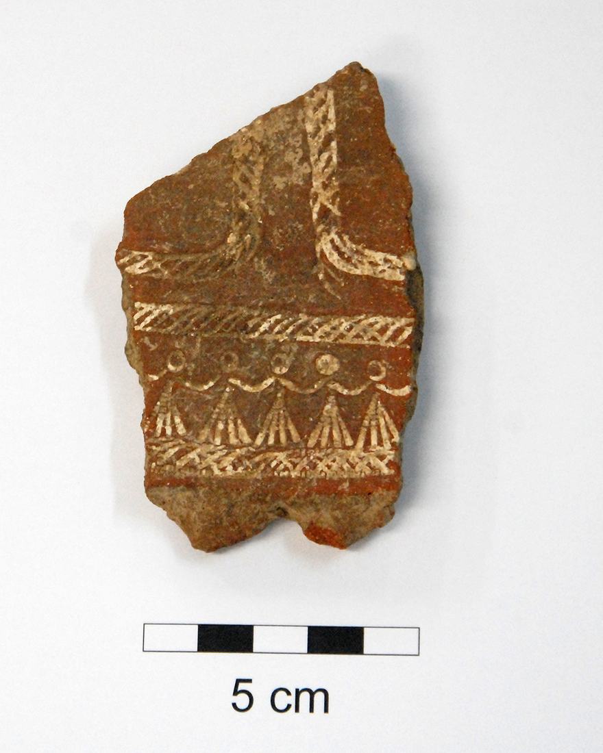
After the great Witori eruption, something new appears in the ground of this region: pottery stamped with fine, toothed patterns of bands, zigzags and faces. Archaeologists call it Lapita.
The people who made it were extraordinary sailors. From the Bismarck Archipelago, of which New Britain is part, their descendants sailed east across open ocean to islands no one had ever lived on: Vanuatu, New Caledonia, Fiji, Tonga and Samoa, in only a few centuries.
They carried pigs, chickens, yams and taro, and the paper mulberry tree, whose bark became the barkcloth of the Pacific. Many people in Polynesia today can trace their ancestry back along this route.
- Began
- about 3,300 years ago
- Sign
- dentate-stamped pottery
- Reached
- as far as Samoa and Tonga
Reef
Kimbe Bay
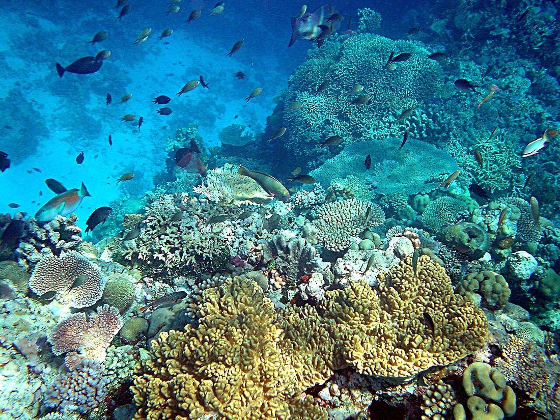
Kimbe Bay curves for about 140 kilometres between the Willaumez Peninsula and Cape Tokoro. Its reefs rise from water more than 2,000 metres deep, so divers drift along walls of coral with nothing but blue below.
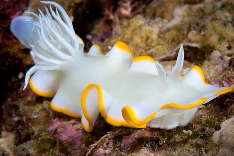
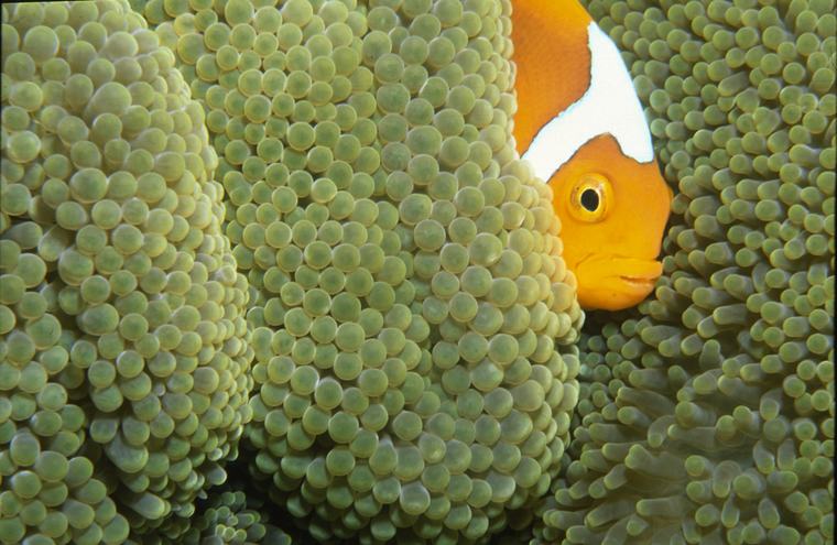
Scientists have counted around 860 kinds of reef fish and 400 kinds of coral here: more than 60 percent of all the coral species of the Indo-Pacific. Sperm whales, orcas, spinner dolphins and dugongs share the bay.
The reefs are looked after by the people who own them. Villages run eight locally managed marine protected areas, which have helped keep dynamite fishing out.
- Reef fish
- about 860 species
- Corals
- about 400 species
- Depth
- more than 2,000 m
Warmth
Eggs in warm ground
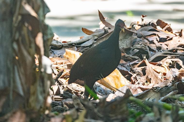
At Pokili, in the Nakanai country, the ground is warm underfoot. Hidden among the trees, the Melanesian megapode, a dark, hen-sized bird with big strong feet, digs deep burrows in the volcanic soil and lays its eggs there.
It never sits on them. The heat of the volcano does the work, and when the chicks hatch they dig their own way up, ready to look after themselves.
Local families collect some of the eggs, and the colony sits inside a wildlife management area so that the harvest can go on. Birdwatchers come for other treasures too: the golden masked owl and the blue-eyed cockatoo, found almost nowhere else.
- Bird
- Melanesian megapode
- Where
- Pokili, Nakanai
- Nest
- a burrow in warm volcanic soil
Cloth
Barkcloth
Across the Pacific, cloth is made not by weaving but by beating. The inner bark of the paper mulberry is stripped, soaked, then pounded on a log with a grooved wooden beater until the fibres spread and knit into a soft sheet.
In West New Britain, the Nakanai people used barkcloth in the ceremonies that honour the dead: to cover funeral masks, and to wrap the bones of relatives before they were kept among the family's wealth. Next door in East New Britain, the Baining build giant barkcloth masks for their night fire dances.
Masks and dances return every year at festivals across the province.
- Festivals
- Maola Ulu Mask Festival, Bali-Vitu
- Balala, East Nakanai · Bakovi, Talasea
- Aulu Nakamutmut, Gloucester
Ask before you photograph a ceremony.
Read the full chapter →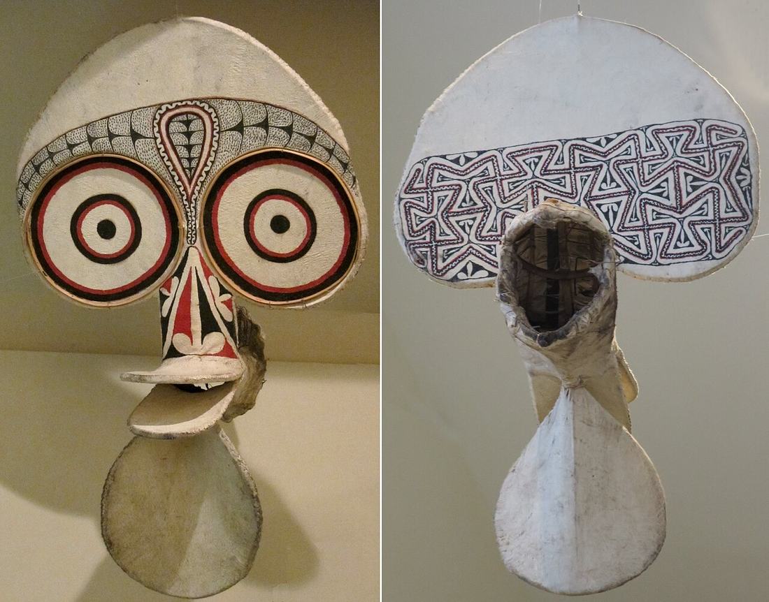
Travel
Getting there
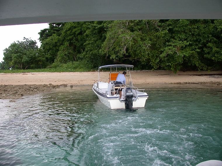
Flights from Port Moresby reach Hoskins in about an hour and a quarter. Kimbe, the provincial capital, is a short drive away on the shore of the bay.
Most visitors come to dive, from resorts on the bay or aboard liveaboard boats, but the island rewards anyone who slows down: hot springs at Pangalu, sulphur ponds at Pokili, forest birds, and sportfishing for dogtooth tuna and blue marlin. At Cape Gloucester, in the far west, Allied troops came ashore on 26 December 1943.
Land and reef belong to local clans. Ask before you walk, fish or photograph, and you will be welcomed.
- Fly in
- Port Moresby → Hoskins
- Flight
- about 1 h 15 min
- Capital
- Kimbe
Colophon
About these notes
westnewbritain.com is a small, independent guide to the nature and story of the island. The photographs come from Wikimedia Commons and are credited on the next page; the chart is drawn from terrain data.
Questions or corrections:
ceo@dottheworld.comSources:
- Australian Museum: volcanic disasters and the beginning of Lapita pottery
- Summerhayes & Allen 1993: Mopir obsidian in late Pleistocene New Ireland
- The Coral Triangle: Kimbe Bay
- PNG Tourism: the wilds of West New Britain
- Penn Museum: the pageant of death in Nakanai
- ReliefWeb: Mt Ulawun eruption, June 2019
Photo credits
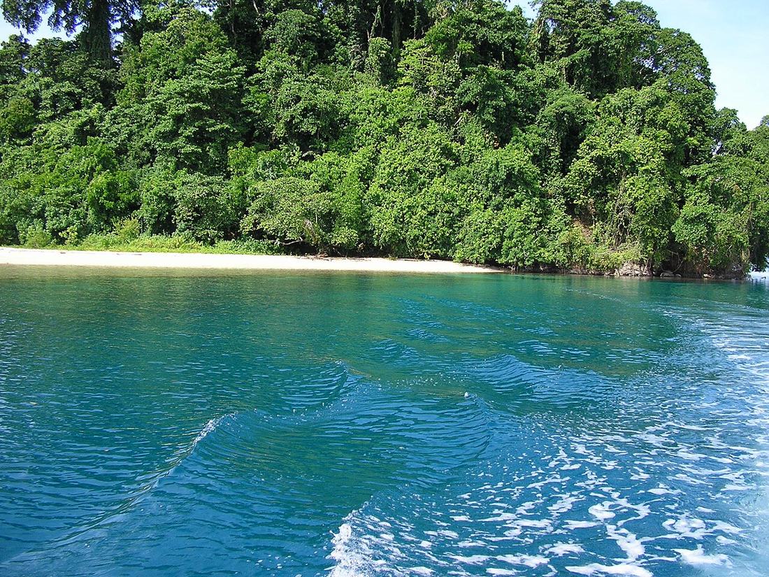
- Restorf Island, Kimbe Bay. Kimbe (en.wikipedia), CC BY-SA 3.0
- Ulawun steaming, seen from the southeast. unknown photographer, Public domain
- Ulawun erupting, photographed from the International Space Station, 30 Nov 2012. NASA, ISS Expedition 34, Public domain
- An obsidian flake in a museum collection. Auckland War Memorial Museum, CC BY 4.0
- A dentate-stamped Lapita sherd excavated at Bourewa, Fiji. Patrick Nunn, CC BY-SA 4.0
- Coral reef, Papua New Guinea. Brocken Inaglory, CC BY-SA 3.0
- Ardeadoris egretta, a nudibranch, Kimbe Bay. Eliot Ferguson, CC BY-SA 3.0
- White-bonnet anemonefish at Walindi, Kimbe Bay. Michael McComb, CC BY 2.0
- Hot springs in the Pokili Wildlife Management Area. sussexbirder, CC BY 2.0
- Melanesian megapode (photographed in the Solomon Islands). Euan Moore, CC BY 4.0
- Baining fire-dance mask of barkcloth and bamboo, front and back (Honolulu Museum of Art). Hiart, CC0
- Malu Malu Island, New Britain. sussexbirder, CC BY 2.0 (cropped & resized)
- Rivers winding through the forest of West New Britain. TianaPNG, CC BY-SA 4.0
All photographs via Wikimedia Commons; cropped, color-balanced and resized for this field notebook under their respective open licenses.
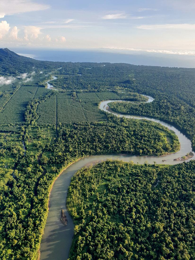
Rivers of West New Britain, seen from the air.
5°30′S · 150°30′E